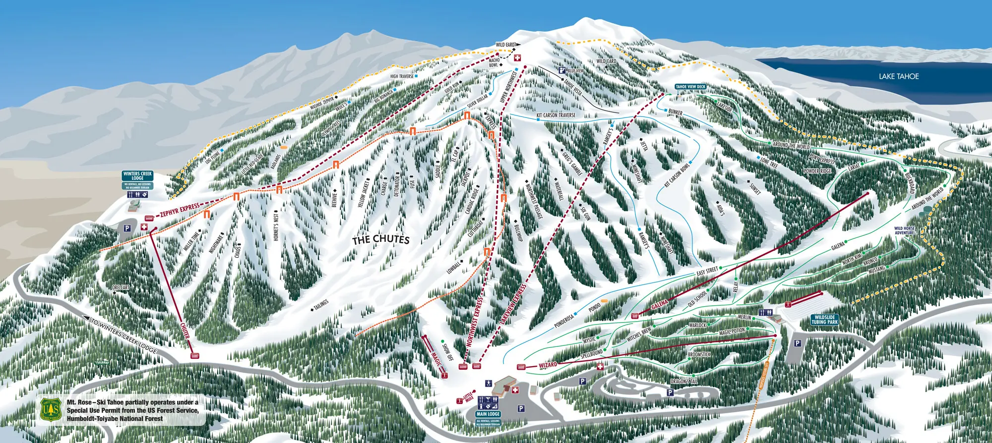
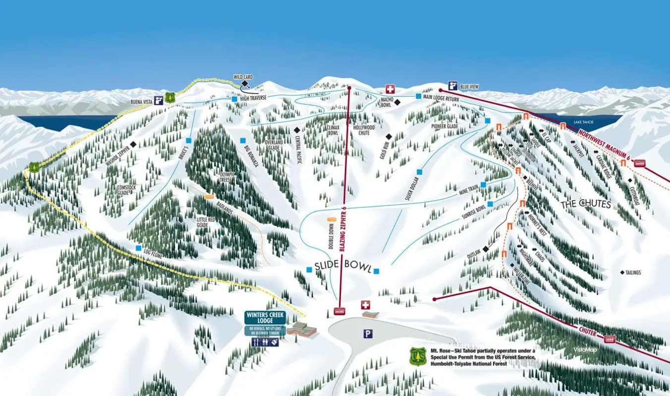
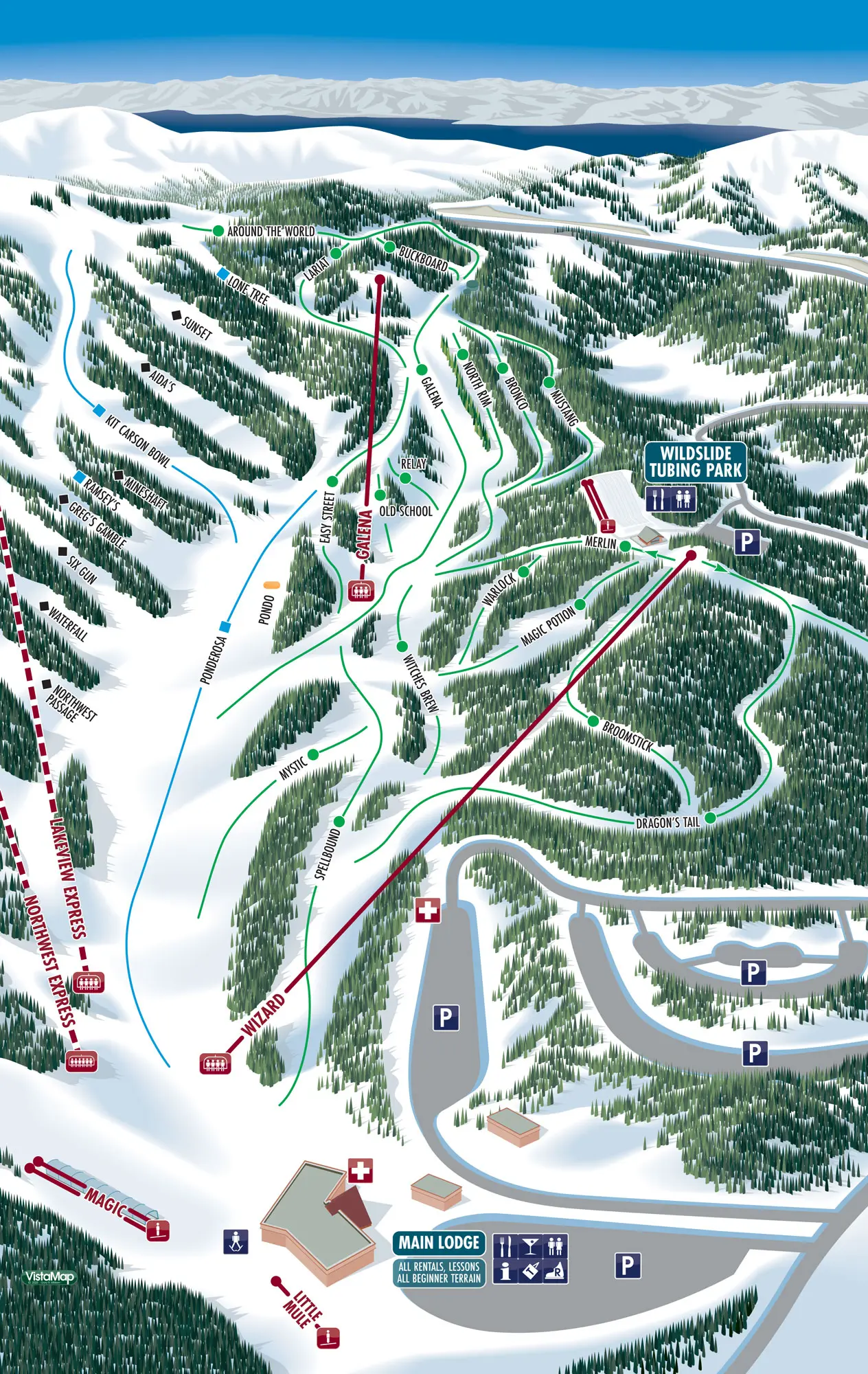
Trail Map
8260′ TAHOE’S HIGHEST BASE ELEVATION
Discover the thrill of Mt. Rose Ski Tahoe with our detailed trail maps. Navigate over 1,200 acres of diverse terrain, from beginner slopes to expert trails, including the renowned “Chutes.” Whether you’re planning your first visit or looking to explore new runs, our interactive trail maps provide some immersive content on lifts, terrain parks, and trail difficulty. Stay updated on current conditions and make the most of your ski adventure.
View and Download High-Resolution Trail Maps (PDF)
Mt. Rose Main Lodge | Mt. Rose Beginner Area | Slide Bowl
New to the area? Here is how to find us.
View iNTERACTIVE mAPS
PArk Features
BACKCOUNTRY ACCESS
Leaving the Mt. Rose Ski Area and entering the Humboldt Toiyabe National Forest back-country. The area behind the exit signs is not patrolled. There is no avalanche control, and Mt. Rose Ski Area is not responsible for rescue operations.
VIEW SIERRA AVALANCHE CENTER ADVISORY
![]() Mt. Rose – Ski Tahoe partially operates under a Special Use Permit from the US Forest Service, Humboldt-Toiyabe National Forest.
Mt. Rose – Ski Tahoe partially operates under a Special Use Permit from the US Forest Service, Humboldt-Toiyabe National Forest.


